Country Directory

Thursday, December 8, 2016

A World Filled With Stars

Starting around the 15th century, the planet began to fill up with stars. Prior to this period, classical fortifications were basically like your average castle or walled city. They relied on defenses that kept men away from the walls while providing height to allow defenders to fire a rain of arrows down at the unlucky attackers. This worked for thousands of years. Archaeologists have discovered that the city of Jericho had a wall surrounding it as early as 10,000 years ago.

Maiden Castle. A large hill fort in Dorset, England.
There were all kinds of defensive structures, from wooden palisades, to the hill forts of ancient Britain, to the enormous Burghausen Castle which extends its stone walls over a kilometer! And these fortresses did their job for most of human history. They worked until the advent of cannons. The walls of these forts and castles tended to be too thin to handle the impact of the new artillery, and their often round shape was more prone to collapse.

To deal with the problem, military engineers began to introduce thick triangular walls and angular ditches with steep slopes to make it more difficult for projectiles to hit their target, and when they did hit, to provide better greater strength for the structure. The changes also eliminated "dead zones", areas where attackers were relatively safe from counter fire. These forts became ever more complex as time went on. To quote the Oxford History of Modern War, "Fortresses... acquired ravelins and redoubts, bonnettes and lunettes, tenailles and tenaillons, counterguards and crownworks and hornworks and curvettes and fausse brayes and scarps and cordons and banquettes and counterscarps..."


Star Forts, as they came to be known, eventually developed into the "polygonal forts" of the late 19th and early 20th centuries, such as Fort Bruyeres near Laon, France.

Fort Bruyeres. Image Source Here

As part of my #FortressEarth project, which seeks to map every fort and castle built between the years 1000 and 1945 that are still visible via satellite, I decided to do a secondary project focused solely on star forts. I found 1,238 such places. These include traditional star forts as well as some of the transitional and polygonal forts that had at least one "triangle" portion or were chevron-shaped. This excludes forts like Bruyeres but includes others like Fort Purbrook in the UK. It also includes "star cities" like Copenhagen and Lucca, Italy. You can download the Google Earth file here.

A classic "star city" - Lucca, Italy (Image: Google Earth)
Click for Larger Image.
Star forts are predominantly found along the coasts and border regions of countries, as well as capital cities. France is a great example of this, whose outline can be easily determined by where French star forts are.


France, apart from having well defended borders, also has a tight ring of 16 star forts (and many other kinds of fortifications) that protected Paris. The Low Countries (Belgium and the Netherlands) have a disproportionate number of star forts, which attest to their own active military history, but also to the fact that they have traditionally been a favored invasion corridor for France and Germany.

I was able to find star forts on every inhabited continent except Australia. Europe has 930, the Americas have 180, Asia has 77, and Africa has 51. It may come as a surprise to some, but the small African country of Ghana has a whoping 14 forts. Unfortunately, these weren't constructed to defend the nation. They were built by the Portuguese to protect the slave trade. You can learn more about "The Slave Fortress of Ghana" here.

Some other interesting bits of information about these beautiful forts:

The northern most star fort in the world (and possibly the most northern fort of any kind) is Norway's Vardøhus Fortress, which is located at 70° 22′ 20″ N, 31° 5′ 41″ E. It is 263 miles above the Arctic Circle!

The southern most is Fort Corral in Chile, at 39°53'20"S 73°25'33" W. It is art of the Valdivian Fort System which the Spanish constructed to protect Corral Bay.

Star forts marked a transitional era in warfare. They arose because of powerful artillery and new tactics, but then, around the 1860s, started to become obsolete - requiring further improvements and the creation of polygonal forts. This last phase of static fortification then finally died out as a powerful means of defense when World War II changed everything. Ballistic missiles weighing thousands of pounds and stealth jets that can reach anywhere in the world, have made traditional above-ground fortifications all but useless. Yet the star forts that remain (as many have been demolished) still stand as testament and guard to human ingenuity and to the history that gave rise to our modern world.

I hope you will find the Google Earth file interesting. And despite the 1,238 forts included, there could still be a few I missed - so keep an eye out! Again, you can download it here.

--Jacob Bogle, 12/8/16
www.JacobBogle.com
Facebook.com/JacobBogle
Twitter.com/JacobBogle


Friday, November 25, 2016

Fortress Haiti

This is part of the #FortressEarth mapping project by Jacob Bogle. For more information, please visit www.JacobBogle.com/fortress-earth.html

Haiti was discovered by Europeans in 1492, when Christopher Columbus landed there and established the settlement of La Navidad (the first European settlement in the Americas during the Age of Discovery). While the settlement was destroyed by native peoples a year later, Spain was not deterred. The town of Puerto Real was created in 1502 which is near modern-day Fort-Liberté. That area saw a succession of forts culminating with the current Fort Liberté, constructed in 1731. Given Haiti's key location in the Caribbean, it was fought over by the Spanish, French, and English. This, of course, gave rise to many fortifications.

Over all, Haiti has 34 fortified sites that still exist and can be seen via satellite.

Click for larger view.

Most of the forts are in the traditional "star fort" style which was popular from the 15th through 18th centuries, which also coincides with Haiti's colonial history.

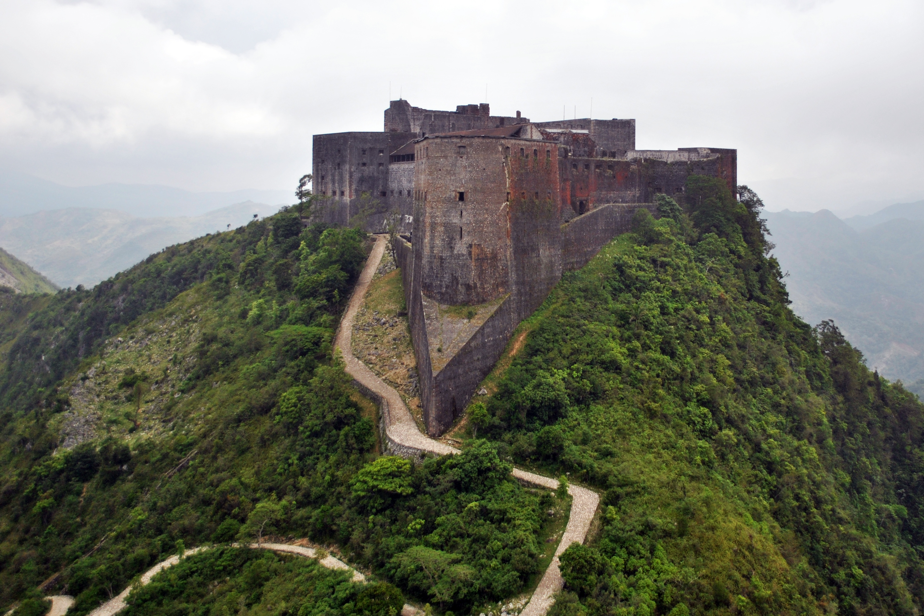
Haiti's most impressive fortification is called Citadelle Laferrière.

Click for larger view.

The fort was built in 1820 by Henri Christophe, who was the ruler of the short-lived Kingdom of Haiti. It is one of three UNESCO World Heritage Sites in Haiti, the other two are also connected to Henri and are within the area of the fort.

Of the smaller forts throughout Haiti, Fort Jacques (which looks out over Port-au-Prince), is quintessential.


It was built by Jean-Jacques Dessalines, a predecessor of Henri Christophe, to defend Haiti during the Haitian Revolution (1791-1804). It was abandoned soon after his death in 1806. You'll notice the thick walls of the fort. Star forts were developed in response to the advent of cannons and powerful artillery. However, unlike Fort Jacques, the forts around the city of Dessalines tended to be simpler stone structures lacking the heft of thick walls.

Dessalines has a line of six forts, extending from the entrance of the city up to the top of the mountain ridge. The town, named after Jean-Jacques Dessalines, a former slave who became emperor of a liberated Haiti, built a line of five forts to defend the country's new capital from the threat of a potential new French invasion during the early 19th century. The sixth fort (Fort Culbute) was constructed during Haiti's colonial days.

Click for larger view.
Here is a collage of each of the six forts.

Click for larger view.

Due to Haiti's tumultuous political and economic history, most of the country's forts are severely damaged. Apart from the Citadel, Fort Liberté is one of the best preserved forts in Haiti. It's also one of the few forts that aren't a traditional "4-point" star fort.

Click for larger view.

I hope you have enjoyed learning about Haiti's fortifications. If you'd like to download the Google Earth file that contains all 34 sites, you can automatically download the file here. To see other files available, visit https://sites.google.com/site/mymappingprojects/


--Jacob Bogle, 11/25/2016
www.JacobBogle.com
Facebook.com/JacobBogle
Twitter.com/JacobBogle

Monday, February 2, 2015

The War in Ukraine

With the Russian-backed rebels claiming they will raise 100,000 men to fight for their cause, I thought it would be interesting to look at the 320-mile long battlefront itself. For some background on the causes of the conflict, please check out my article on the subject.

As usual, to see a larger view of an image simply click on it.

An overview of the conflict in the Donbass Region of Ukraine.

The fighting started over Crimea's annexation by Russia in March 2014. Russia claimed it because it has a majority Russian-language speaking population. Likewise, the Donbass Region has large pockets of predominately Russian speakers, and in the turmoil of the 2014 Ukrainian Revolution, groups of separatists (supported by Russia) began to take over cities in Donbass. Currently, the large cities of Donetsk and Luhansk are under rebel control, and the key city of Mariupol has also come under attack, though it remains in Ukrainian control.

The rebels have received vast amounts of money and equipment from Russia on top of the Ukrainian military supplies they've captured. Russia has also invaded Ukraine on multiple occasions; sending thousands of troops, tanks, and artillery into the country. 

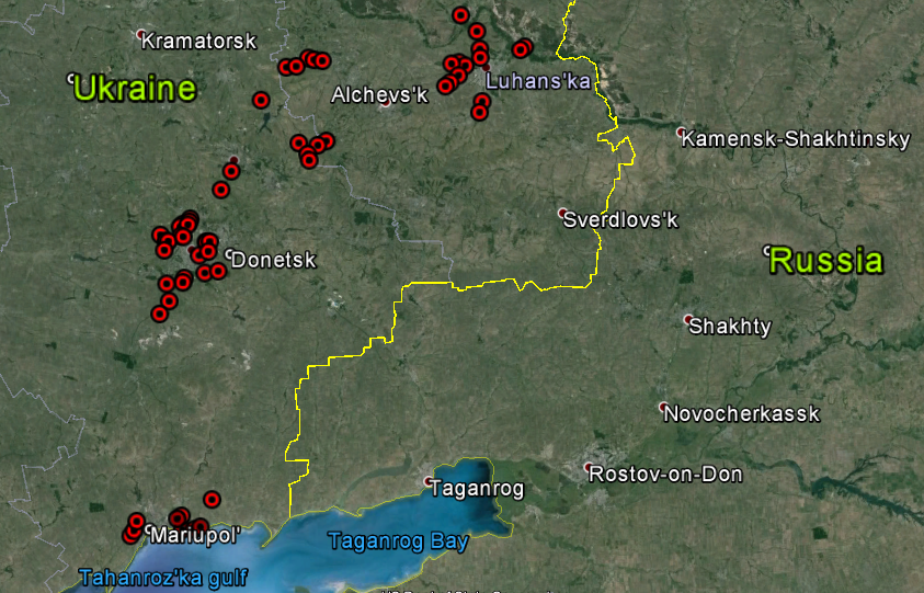
I have gone through the area and found 127 visible sites relating to the war, along with 14 key airports and 23 border crossings. If you'd like to see them all, please feel free to download the Google Earth file I've made. (File [KMZ type] is hosted on Google Forums and automatically downloads.)

First, I'd like to show you Ukraine's capital, Kiev, before and during the Euromaidan protests which started the 2014 Revolution. 


Here's a wide view at all the sites in Donbass and Crimea.

Donbass.

Crimea.

Here are some pictures of the conflict around the city of Donetsk.


Shelling damage at Donetsk Airport.

On May 26, 2014, rebels clashed with Ukrainian troops at Donetsk International Airport (which also had a military base attached). Ukraine won the initial battle but beginning in late September, rebels launched a new offensive and took control of the airport and base. 
Here are before and after photos of the military base.

Before.

After. You can clearly see burnt regions and numerous bomb craters.

Below is a comparison of the related weapons storage area.


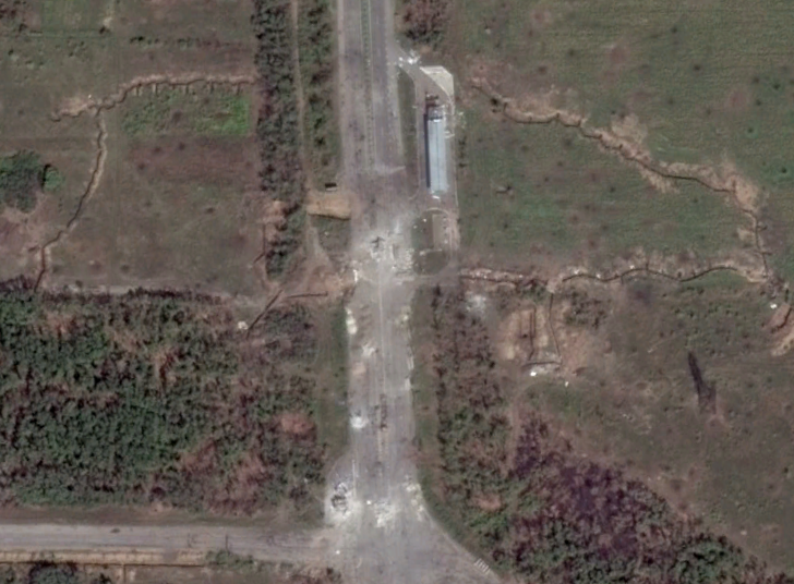
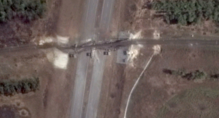
Two damaged bridges with checkpoints. 

And finally for Donetsk, here are some trench fortifications.

Next comes Luhansk:

Fortifications and battle damage.

A destroyed bridge.

Some sites around Debal' steve:

Road block and trenches.

Fortifications.


Sites around Mariupol:

Gun emplacements.

A great example of Ukrainian fortifications and road block.

Here's some mobile artillery dug-in in Crimea.

Here are a few other images from around the Donbass Region:

This is the Druzhba Sports Facility. It was ransacked after rebels captures Donetsk. You can see part of the building is burnt out (lower side). 

This is another destroyed bridge.

Finally, the crash site of Malaysian Airlines Flight MH 17 which was shot down over rebel-held territory on July 17, 2014 killing all 298 people on board.  


Friday, January 16, 2015

Prisons of Cuba

I have found 32 active Cuban prisons as well as identified 4 other locations which may be prisons. This exclude whatever small town jails there may be. Given Cuba's population of 11.2 million, this means that there is a large prison for every 350,000 people; if we include the additional 4 "maybe's", that gives a ratio of 1:311,000. These ratios are actually better than those of the United States which has the largest prison population in the entire world.

In terms of prisons per square mile, Cuba has 1 confirmed prison per 1,337 sq. mi. There are four regions which have multiple prisons within a relatively small area: Havana, Santa Clara, Camaguey, and Holguin.

As I'll show further below, many of their prisons are located near or inside of industrial facilities. According to Human Rights Watch, as of May 2012, some 57,000 Cubans were in prison or labor camps.

Here are some maps of prison locations (click on the images for a larger view):

Locations of confirmed prisons. 

Possible prisons. 

Prisons around Havana. 

Prisons around Holguin. 

Prisons around Camaguey and Santa Clara

Here are some closeup satellite images of prisons, some of which clearly show they're part of labor/industrial complexes. 

This is Alambradas de Manacas Prison. I've marked out key features.
It's location is: 22°33'47.7"N 80°21'10.3"W

Here's a closer view of the 4 prisons in northern Santa Clara. 

This shows the two prisons at the center of the previous Santa Clara image. This particular picture clearly shows the prisons are in the industrial region of the city.

This is Jovellanos Prison (outlined in black). It too is next to a factory.
It's location is: 22°48'10.3"N 81°10'29.4"W

This prison is to the east of Havana, in the outlying town of Guanabacoa. This large prison complex covers about 93 acres, and to the far right of this image there's a factory which is very much visible. If you view the full image, you can also see that the factory is surrounded by the same fence system as the rest of the prison - this makes it abundantly clear that prison labor is being used. 
It's specific location is: 23°06'27.8"N 82°14'28.7"W

Products produced by prison labor include, furniture, clothing, and agricultural products. While prisoners are generally paid for their work, by the time government fees are taken out, the amount each prisoners receives is drastically reduced. Of course there are plenty of reports of prisoners not being paid at all. Within the Cuban prison system, there is widespread abuse and safety measures in the labor camps are basically nonexistent leading to many injuries. 

--Jacob Bogle