Country Directory

Showing posts with label forts. Show all posts

Monday, July 10, 2017

Fortress Turkey

Rumelian Castle. Image source: Commons.

Turkey's location at the crossroads of Europe, Asia, and the Middle East means it has some of the richest and most diverse history anywhere in the world. Constantly fought over, Turkey can also boast hundreds of forts and castles going back thousands of years. Since the main focus of #FortressEarth is to find sites constructed no earlier than 1000 AD (or at least still in use by) this means Byzantine, Seljuk, Ottoman, and modern-era fortifications, as well as sites constructed by Russians and others during various wars. I have been able to find 283 fortified sites and related structures. Given Turkey's complex history and equally complex territory, there are undoubtedly sites I have missed, but I am confident that this map has a majority of them.

The three main sources of information I used to locate these sites were Wikipedia, Wikimapia, and Castles.nl. Roughly 60% were found by me methodically scanning Google Earth.

If you zoom in a little on the map below, some of the interesting things you can discern are the main invasion routes into Anatolia. Groups of fortifications around Istanbul (Constantinople), several defending the Dardanelles to the south, and if you look near the border with Bulgaria, you can find multiple forts defending Edirne. Edirne (Adrianople) served as the Ottoman capital for 90 years before they were finally able to capture Constantinople in 1453. Adrianople has been called the most contested piece of land on earth - having been under siege no fewer than 17 times since 313 AD.

Across the peninsula, in the region near the border with Georgia, you can find the main invasion routes into the region from Russia and Armenia. This area was the site of many large battles. To the south, you see the way defended from invasions coming north from Syria. Finally, you can see the string of castles all along the southern coast which served to defend Anatolia from many foes through the ages.

Based on this map, the interior is unusually empty of castles. I suppose this is due to the fact that while the borders of Byzantium and the Ottoman Empire were constantly under threat, once one side or another conquered the interior, they tended to hold it - making the need for huge numbers of castles generally unnecessary. The ones that do exist protected key cities, regional capitals, and a few important trade routes.

If you would like to directly download the Google Earth file to explore more easily (and have access some additional content in some cases), simply click here.


If you know of any places I missed, have any corrections, or other comments, you can either contact me via the links below or simply comment on this article.

--Jacob Bogle, 7/10/17

Friday, November 25, 2016

Fortress Haiti

This is part of the #FortressEarth mapping project by Jacob Bogle. For more information, please visit www.JacobBogle.com/fortress-earth.html

Haiti was discovered by Europeans in 1492, when Christopher Columbus landed there and established the settlement of La Navidad (the first European settlement in the Americas during the Age of Discovery). While the settlement was destroyed by native peoples a year later, Spain was not deterred. The town of Puerto Real was created in 1502 which is near modern-day Fort-Liberté. That area saw a succession of forts culminating with the current Fort Liberté, constructed in 1731. Given Haiti's key location in the Caribbean, it was fought over by the Spanish, French, and English. This, of course, gave rise to many fortifications.

Over all, Haiti has 34 fortified sites that still exist and can be seen via satellite.

Click for larger view.

Most of the forts are in the traditional "star fort" style which was popular from the 15th through 18th centuries, which also coincides with Haiti's colonial history.

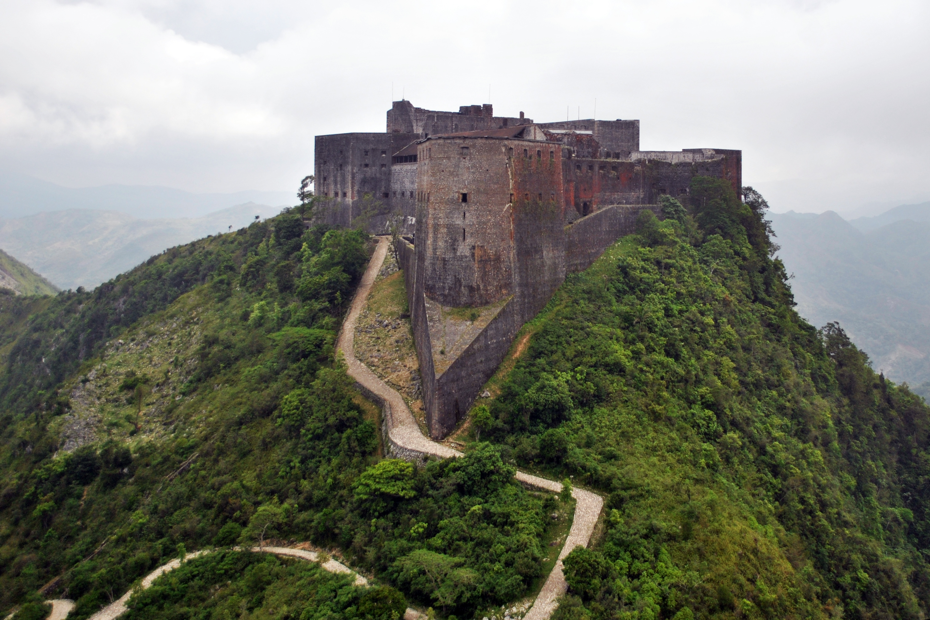
Haiti's most impressive fortification is called Citadelle Laferrière.

Click for larger view.

The fort was built in 1820 by Henri Christophe, who was the ruler of the short-lived Kingdom of Haiti. It is one of three UNESCO World Heritage Sites in Haiti, the other two are also connected to Henri and are within the area of the fort.

Of the smaller forts throughout Haiti, Fort Jacques (which looks out over Port-au-Prince), is quintessential.


It was built by Jean-Jacques Dessalines, a predecessor of Henri Christophe, to defend Haiti during the Haitian Revolution (1791-1804). It was abandoned soon after his death in 1806. You'll notice the thick walls of the fort. Star forts were developed in response to the advent of cannons and powerful artillery. However, unlike Fort Jacques, the forts around the city of Dessalines tended to be simpler stone structures lacking the heft of thick walls.

Dessalines has a line of six forts, extending from the entrance of the city up to the top of the mountain ridge. The town, named after Jean-Jacques Dessalines, a former slave who became emperor of a liberated Haiti, built a line of five forts to defend the country's new capital from the threat of a potential new French invasion during the early 19th century. The sixth fort (Fort Culbute) was constructed during Haiti's colonial days.

Click for larger view.
Here is a collage of each of the six forts.

Click for larger view.

Due to Haiti's tumultuous political and economic history, most of the country's forts are severely damaged. Apart from the Citadel, Fort Liberté is one of the best preserved forts in Haiti. It's also one of the few forts that aren't a traditional "4-point" star fort.

Click for larger view.

I hope you have enjoyed learning about Haiti's fortifications. If you'd like to download the Google Earth file that contains all 34 sites, you can automatically download the file here. To see other files available, visit https://sites.google.com/site/mymappingprojects/


--Jacob Bogle, 11/25/2016
www.JacobBogle.com
Facebook.com/JacobBogle
Twitter.com/JacobBogle