Country Directory

Showing posts with label history. Show all posts

Tuesday, October 17, 2017

Fortress Cuba

Cuba has always been a magical place filled with beautiful people and valuable resources (not to mention its prime location in the Caribbean between North, Central, and South America). While Cuba has been inhabited for at least 6,000 years, it wasn't "discovered" by Europeans until the year 1492 (by everyone's favorite controversial explorer, Christopher Columbus).

Cuba remained a jewel in the Spanish Empire's crown for centuries until it was relinquished to the United States in 1898. To protect the Spanish from locals (and more importantly, pirates) a series of forts were constructed, primarily in Havana and Santiago. Eventually, these forts were refitted and expanded as Cuba's military importance grew and as the island was dragged into the wars of Europe - such as Britain's conquest of Cuba in 1762 during the Seven Year's War (it was quickly returned to Spain in 1763 with the Treaty of Paris that ended the war) and conflicts with France.

The forts of Havana, Cuba.

Since most of the current forts were constructed in the late 1500s to mid-1700s, many share the 'star fort' or 'bastion fort' innovation that arose in Europe in the mid-1400s which enabled forts to withstand cannon barrages much more effectively than earlier styles of fortification.

With a few exceptions, Cuba's forts are centered around Havana. One of the great losses of Cuba's history, are the 5 km of walls that once surrounded the old city of Havana. They were constructed between 1674 and 1740, contained 11 gates, and rose to 10 meters in height, but the walls were demolished starting in 1863. Only a few very small segments remain. However, like many cities that no longer retain their walls, the path of the walls can be readily identified, as roads are often constructed along their former path.

Comparison of the old city of Havana. (Left) a 1853 map showing the city walls, (Right) a current satellite image showing where the walls once stood.

The largest fort in Cuba is the Fortaleza de San Carlos de la Cabaña which sits atop a high bluff on the eastern entrance to Havana Harbor. It is roughly 2,300 feet across.


Find out more about #FortressCuba and its 14 forts by downloading the Google Earth File here, or you can explore the map below.


As always, if there's an error or a missing place (that you have the exact location of), please let me know. Projects like Fortress Earth only work when people share their knowledge.

--Jacob Bogle, 10/18/17
JacobBogle.com
Facebook.com/JacobBogle
Twitter.com/JacobBogle

Friday, November 25, 2016

Fortress Haiti

This is part of the #FortressEarth mapping project by Jacob Bogle. For more information, please visit www.JacobBogle.com/fortress-earth.html

Haiti was discovered by Europeans in 1492, when Christopher Columbus landed there and established the settlement of La Navidad (the first European settlement in the Americas during the Age of Discovery). While the settlement was destroyed by native peoples a year later, Spain was not deterred. The town of Puerto Real was created in 1502 which is near modern-day Fort-Liberté. That area saw a succession of forts culminating with the current Fort Liberté, constructed in 1731. Given Haiti's key location in the Caribbean, it was fought over by the Spanish, French, and English. This, of course, gave rise to many fortifications.

Over all, Haiti has 34 fortified sites that still exist and can be seen via satellite.

Click for larger view.

Most of the forts are in the traditional "star fort" style which was popular from the 15th through 18th centuries, which also coincides with Haiti's colonial history.

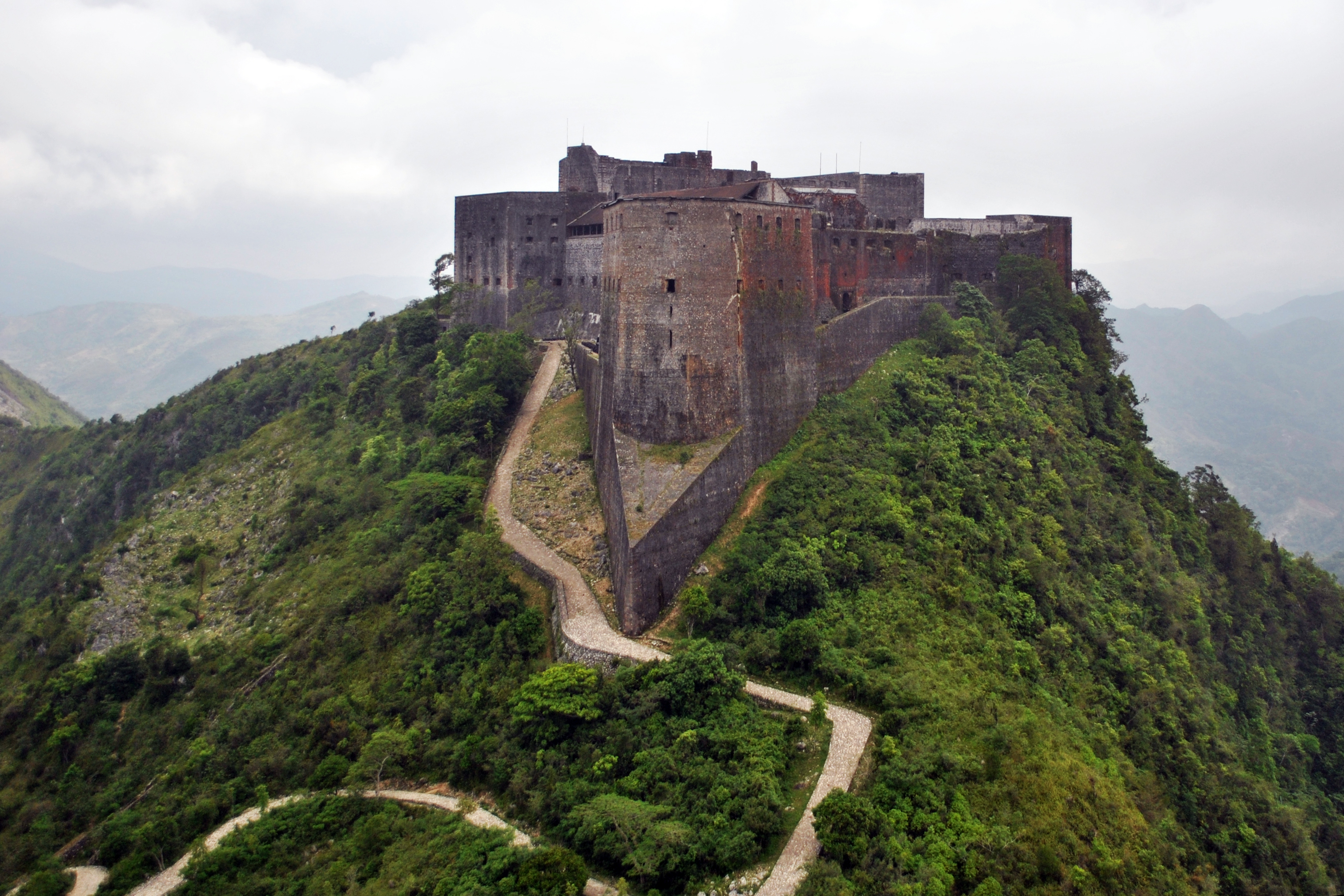
Haiti's most impressive fortification is called Citadelle Laferrière.

Click for larger view.

The fort was built in 1820 by Henri Christophe, who was the ruler of the short-lived Kingdom of Haiti. It is one of three UNESCO World Heritage Sites in Haiti, the other two are also connected to Henri and are within the area of the fort.

Of the smaller forts throughout Haiti, Fort Jacques (which looks out over Port-au-Prince), is quintessential.


It was built by Jean-Jacques Dessalines, a predecessor of Henri Christophe, to defend Haiti during the Haitian Revolution (1791-1804). It was abandoned soon after his death in 1806. You'll notice the thick walls of the fort. Star forts were developed in response to the advent of cannons and powerful artillery. However, unlike Fort Jacques, the forts around the city of Dessalines tended to be simpler stone structures lacking the heft of thick walls.

Dessalines has a line of six forts, extending from the entrance of the city up to the top of the mountain ridge. The town, named after Jean-Jacques Dessalines, a former slave who became emperor of a liberated Haiti, built a line of five forts to defend the country's new capital from the threat of a potential new French invasion during the early 19th century. The sixth fort (Fort Culbute) was constructed during Haiti's colonial days.

Click for larger view.
Here is a collage of each of the six forts.

Click for larger view.

Due to Haiti's tumultuous political and economic history, most of the country's forts are severely damaged. Apart from the Citadel, Fort Liberté is one of the best preserved forts in Haiti. It's also one of the few forts that aren't a traditional "4-point" star fort.

Click for larger view.

I hope you have enjoyed learning about Haiti's fortifications. If you'd like to download the Google Earth file that contains all 34 sites, you can automatically download the file here. To see other files available, visit https://sites.google.com/site/mymappingprojects/


--Jacob Bogle, 11/25/2016
www.JacobBogle.com
Facebook.com/JacobBogle
Twitter.com/JacobBogle